
DEP Assesses Coastal Erosion From Ian Around Cape May County
A post-storm assessment was conducted on October 6th by the New Jersey Department of Environmental Protection. Here is a summary of the results from around the area, along with the severity of the damage. The word scarp is a geological term, defined as “a low steep slope along a beach caused by wave erosion”.
Ocean City – Damage Level: Major
Up to 50’ of sloped erosion up to 2’ in height throughout the City. Various sections of vertical dune scarps, ranging from to 2’ to 6’ in height north of the 12th St. with total dune loss from south of 5th St. through near 7th St. Some wave runup/tide to the upper beach/dunes with some runup into the dunes.
Strathmere – Damage Level: Major
Up to 50’ of sloped erosion, up to 3’ in height, with sections of vertical dune scarping up to 14’ in height and up to 20’ in width from Seaview Ave. south through Whale Beach. 50% or more of the USACE engineered dune is missing north of Winthrop Ave. (3 blocks) with almost no dune left at Seaview Ave. Wave runup/tide to the upper beach/dune with some runup into the dunes. Several access points impacted or closed north of Williams Ave.
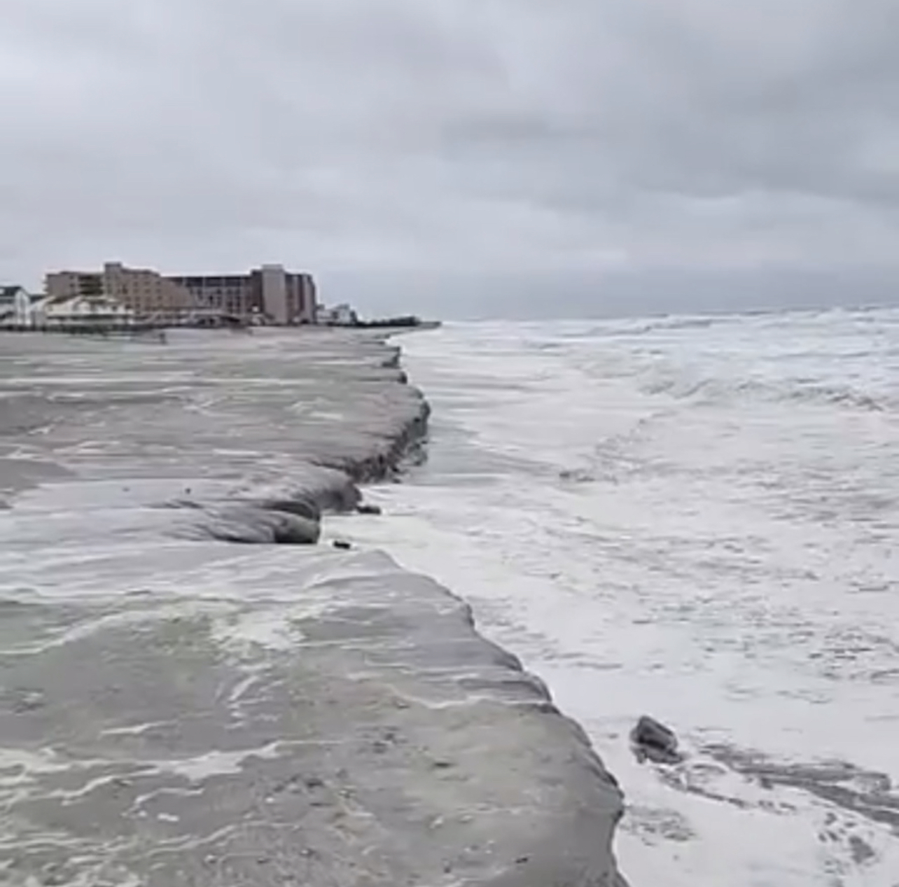
Sea Isle City – Damage Level: Major
Whale Beach to Townsend Inlet Waterfront Park: Up to 75’ of sloped erosion, up to 4’ in height with vertical dune scarping up to 14’ in height and up to 15’ in width, with the focus near JFK Blvd. and south of 88th St; much of which is to the USACE engineered dune. Wave runup/tide to the upper beach/dune with some runup into the dunes. Some access impacted near JFK Blvd. And most access impacted or closed south of 84th St.
Avalon – Damage Level: Major
Up to 50’ of sloped erosion, up to 4’ in height with vertical dune scarping up to 14’ in height and up to 30’ in width (between 11 th St. and 23rd St.), some of which may be to the USACE engineered dune. Wave runup/tide to the upper beach/dune. Multiple beach access points closed and damaged between 12th St. and 23rd St. Wave runup/tide to the upper beach/dune with some runup into the dunes
Stone Harbor – Damage Level: Major
Up to 60’ of sloped erosion, up to 4’ in height. Vertical dune scarping, throughout the Borough, up to 10’ in height and up to 15’ in width, some of which may be the USACE engineered dune. Wave runup/tide to the upper beach/dune with some runup into the dunes. Many access points closed and damaged.
North Wildwood, Hereford Inlet & Surf Ave – Damage Level: Minor
Up to 50’ of sloped erosion, up to 3’ in height. Wave runup/tide to the upper beach/dune/seawall with some runup into the dunes. No major incidents or damage observed or reported to the inlet beach and inlet seawall.
North Wildwood, Elsewhere – Damage Level: Major
2nd Ave to 8th Ave: Up to 75’ of sloped erosion, up to 4’ in height. Wave runup/tide to the upper beach/revetment/bulkhead. Accessways closed.
8th Ave to 16th Ave: Up to 80’ of sloped erosion, up to 4’ in height with vertical dune scarps, up to 14’ in height and up to 35’ in width (mostly between 13th Ave. and 16th Ave.) Wave runup/tide to the upper beach/dune with some runup into the dunes. Most access impacted or closed and damaged between 2nd and 7th Ave. and between 13th Ave. and 16th Ave.
16th Ave to Wildwood border: Up to 80 feet of sloped erosion, up to 3’ in height. Wave runup/tide to the upper beach/dune with some runup into the dunes and in-between the southern piers.
Wildwood City – Damage Level: Minor
Up to 250’ of sloped erosion, up to 3’ in height and redistribution of sand. Wave runup/tide to the upper beach. Evidence of berm top ponding. No major incidents or damage observed or reported
Wildwood Crest – Damage Level: Minor
Up to 225’ of sloped erosion, up to 3’ in height and redistribution of sand. Wave runup/tide to the upper beach/dune. Evidence of berm top ponding. No major incidents or damage observed or reported
Diamond Beach – Damage Level: Minor
Up to 200’ of sloped erosion, up to 3’ in height and redistribution of sand. Wave runup/tide to the upper beach. Evidence of berm top ponding. No major incidents or damage observed or reported
Cape May City – Damage Level: Minor
Up to 15’ of sloped erosion, up to 2’ in height and redistribution of sand. Wave runup/tide to the upper beach/dune with some runup into the dunes. Evidence of berm top ponding at the Cove Beach.
West Cape May – Damage Level: Minor
Minor sloped erosion and redistribution of sand. Wave runup/tide to the upper beach/dune. No major incidents or damage observed or reported. Evidence of berm top ponding.
Cape May Point – Damage Level: Minor
Minor sloped erosion and redistribution of sand. Wave runup/tide to the upper beach/dune. No major incidents or damage observed or reported.
North Cape May / Villas – Damage Level: Minor
Up to 20’ of sloped erosion up to 2’ in height with isolated vertical dune scarps up to 3’ in height and 5’ in width. Wave runup/tide to the upper beach/dune with some runup into the dunes and upland areas. No major incidents or damage observed or reported.
Del Heaven to Reeds Beach – Damage Level: Minor
Up to 20’ of sloped erosion up to 2’ in height. Wave runup/tide to the upper beach with some runup into the dunes and upland areas. No major incidents or damage observed or reported.