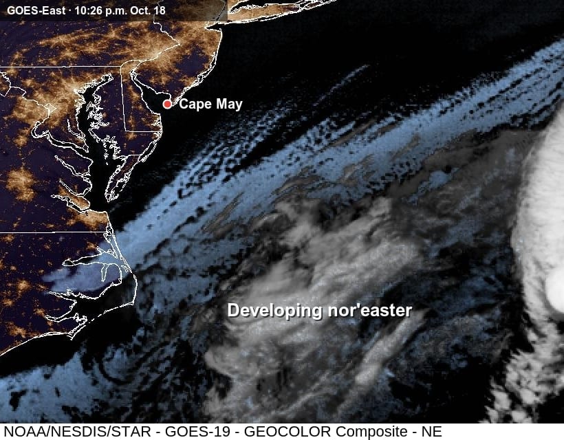
CAPE MAY, Oct. 18, 2026 — A nor'easter forming off the North Carolina coast is expected to bring several rounds of coastal flooding to Cape May County this week, the National Weather Service in Mount Holly says.
The storm is forecast to strengthen and drift offshore through at least Wednesday. Its steady northeast winds will push water toward the coast and raise each high tide, forecasters wrote Sunday evening.
Tuesday evening
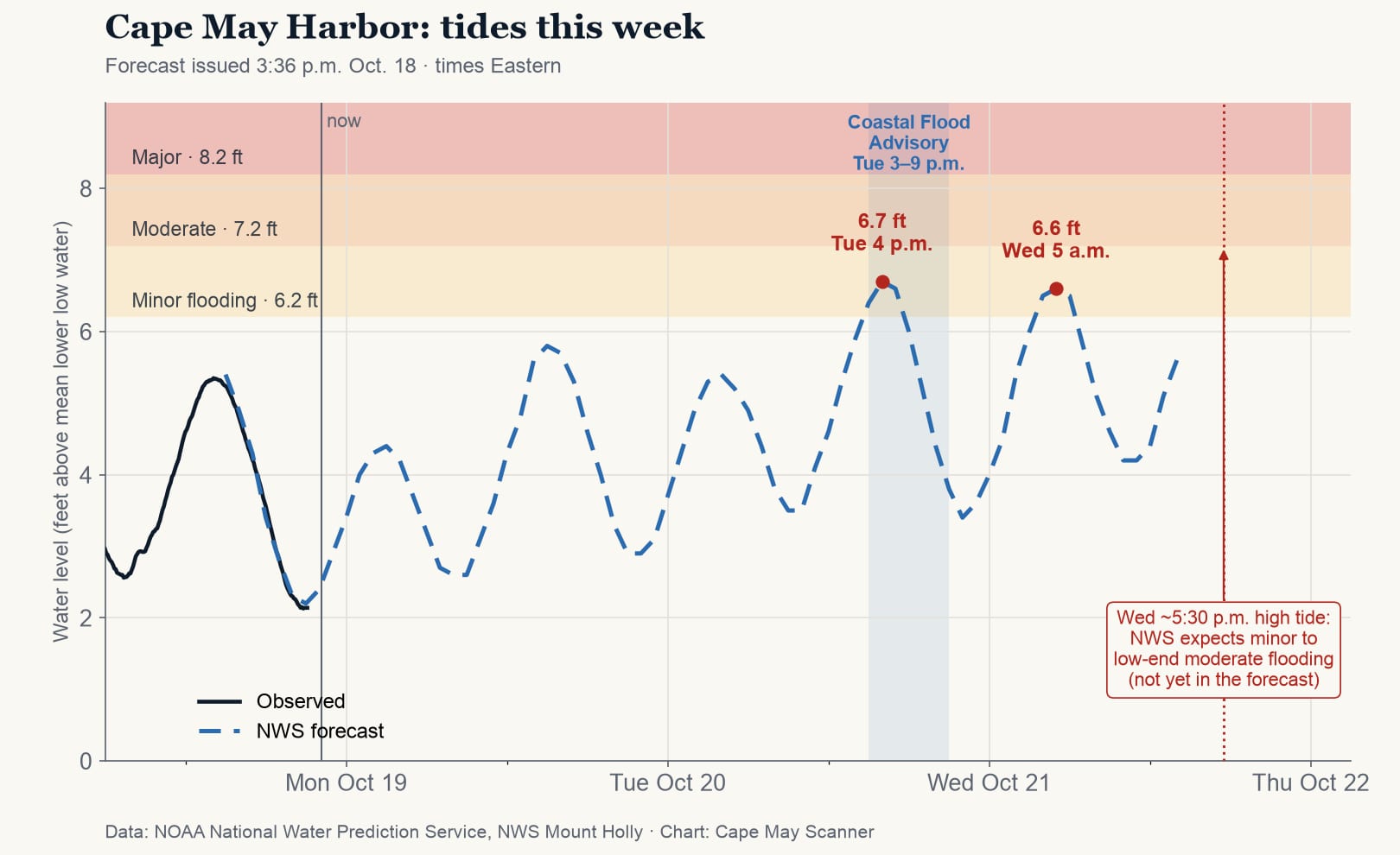
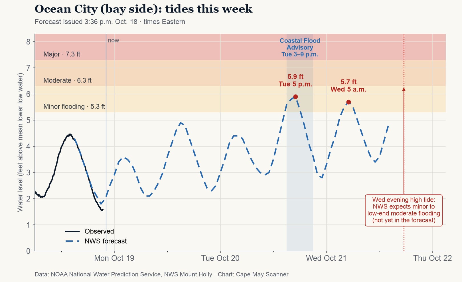
A Coastal Flood Advisory is in effect for Cape May County from 3 to 9 p.m. Tuesday. Up to a foot of water is expected in low-lying areas near shorelines and tidal waterways, and some roads may close, according to the weather service.
At the Cape May Harbor gauge, the tide is forecast to reach 6.7 feet around 4 p.m. Tuesday, above the 6.2-foot level where minor flooding begins. The bay gauge at Ocean City is forecast to reach 5.9 feet around 5 p.m., above its 5.3-foot minor flood level.
More high tides to come
The next high tide, around 5 a.m. Wednesday, is forecast to reach 6.6 feet at Cape May, and forecasters say another advisory will likely be needed.
Wednesday evening's high tide, around 5:30 p.m. at Cape May, is currently the one of most concern, with widespread minor to low-end moderate flooding expected, the weather service said Sunday night. Moderate flooding begins at 7.2 feet on the Cape May Harbor gauge. Rounds of flooding are expected through at least Wednesday night.
Beach erosion is possible, and gusts of 30 to 35 mph are possible along the immediate coast. Little or no rain is expected. A Gale Warning is in effect for the coastal waters through Tuesday night.
Before the tide comes in
The weather service advises against parking where streets flood at high tide and against driving through flood water, which can be deeper than it looks. Live water levels for the Cape May gauge are posted on the National Water Prediction Service at water.noaa.gov.
Sources: National Weather Service, Mount Holly; NOAA tide predictions for Cape May.