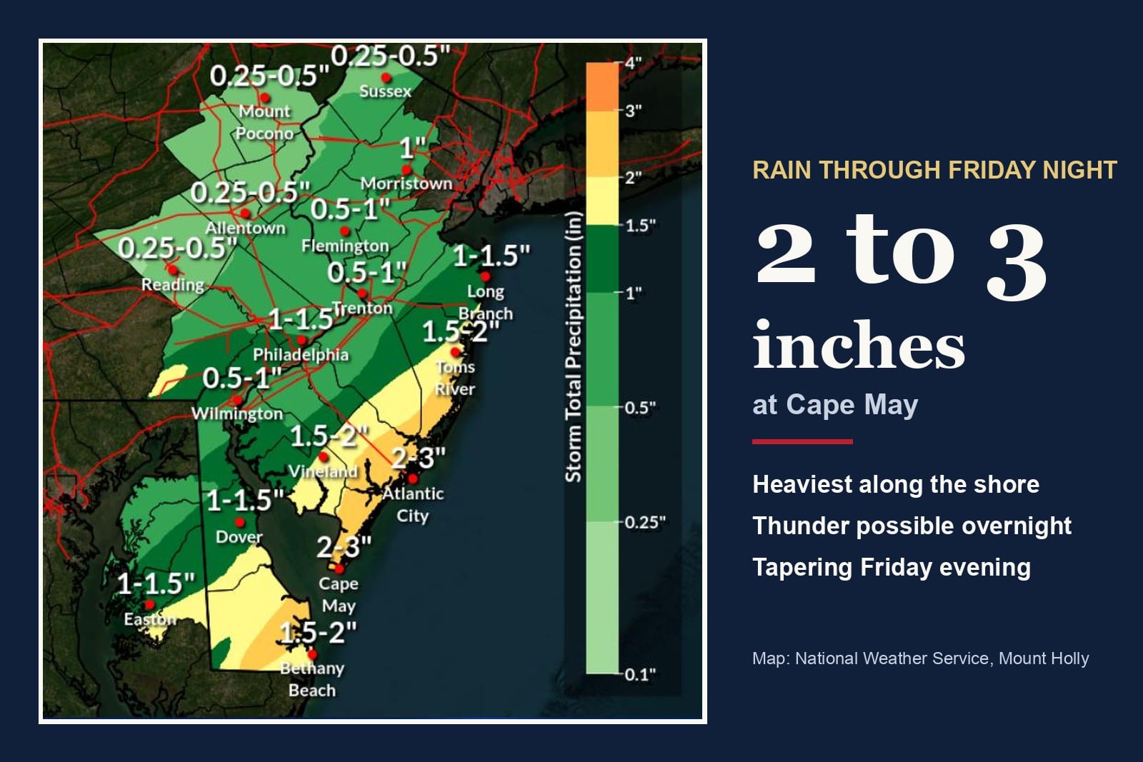
CAPE MAY COURT HOUSE, Nov. 7, 2026 — A coastal storm that could strengthen into a nor'easter may reach the region late next week, with rain possible in Cape May County from Thursday night into Friday night, the National Weather Service in Mount Holly says.
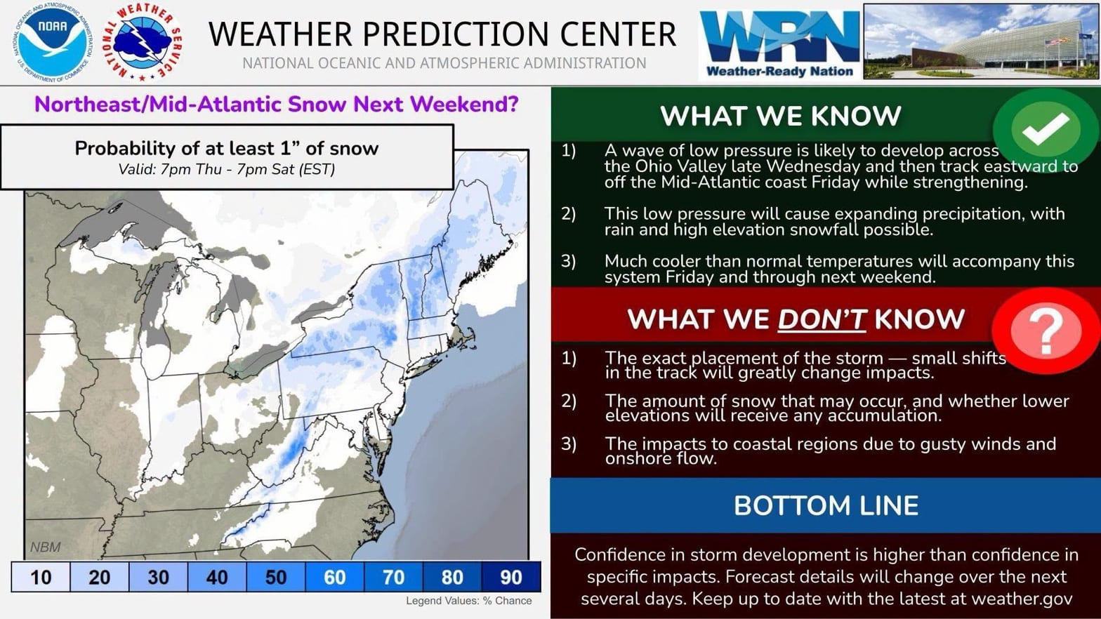
Low pressure is likely to form over the Ohio Valley late Wednesday and track east, moving off the Mid-Atlantic coast Friday while strengthening, according to the federal Weather Prediction Center. Mount Holly forecasters wrote Saturday evening that a second low may develop near the northern Mid-Atlantic, and where it forms and tracks will decide who gets what.
Snow looks unlikely at the shore. The Weather Prediction Center puts the chance of at least an inch of snow from 7 p.m. Thursday to 7 p.m. Saturday at under 10% across South Jersey. Colder air could bring a rain-snow mix or some snow to the far western and northwestern parts of the Mount Holly forecast area, while "elsewhere, a decent amount of rain is possible," forecasters wrote.
The coastal impacts are the least certain part. Stronger winds and tidal flooding are possible, but if the low tracks over the region instead of offshore, the onshore wind would not last as long, Mount Holly says. The Weather Prediction Center also lists "the impacts to coastal regions due to gusty winds and onshore flow" among the things it doesn't know yet.
Much cooler than normal temperatures will come with the storm Friday and last through next weekend, the Weather Prediction Center says.
"Confidence in storm development is higher than confidence in specific impacts," the center says. "Forecast details will change over the next several days."
Until then, it stays breezy. Sunday will be partly sunny with highs in the low 60s and west winds gusting to about 20 mph.